The opinion of Aventure Nordique
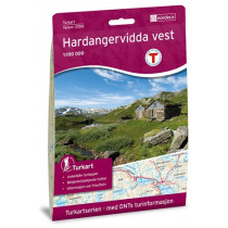
The hiking map Hardangervidda Vest at 1: 50 000 covers the western part of the Hardanger plateau. The card allows you to view shelters Hadlaskard, Hedlo, Viveli, Stavali, Torehytten, Reinaskorsbu, Litlos, Kvanntjørnsbu. The map covers the area of Hårteigen. The Hardangervidda Vest map is compatible with the GPS system (UTM grid).
Points to remember
La carte Hardangervidda Vest est compatible avec le système GPS (grille UTM).
Technical details
| Manufacturer | Nordeca |
|---|---|
| Country | Norway |
| Type | Hiking map |
| Series | Turkart |
| Sheet reference | 2659 |
| Article number | 2659 |
| EAN | 7046660026595 |
| Date of publication | 2018 |
| Scale | 1:50 000 |
| Folded size | 14,2 x 20,6 cm |
| Weight | 55 g |
| Warranty | 2 years |
| Country of Manufacture | Norway |