The opinion of Aventure Nordique
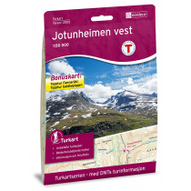
Hiking map of the Aust Jotuheimen mountain and the Bessengen Ridge (Norway). The topographic map at 1: 50 000 covers the eastern part of Jotunheimen. The back of the map contains touristic informations in english, german and norwegian. Jotunheimen Aust map, compatible with the GPS system, covers the top of Glittertinden the sector Bessengen Ridge.
Points to remember
Idéale pour préparer un trekking dans l'Est du massif du Jotunheimen. Carte compatible avec le système GPS. Papier résistant à l'humidité.
Technical details
| Brand | Nordeca |
|---|---|
| Country | Norway |
| Type | Hiking map |
| Series | Turkart |
| Sheet reference | 2503 |
| Article number | 2503 |
| EAN | 7046660025031 |
| Date of publication | 2022 |
| Scale | 1:50 000 |
| Folded size | 14,3 x 20,8 cm |
| Weight | 56 g |
| Warranty | 2 years |
| Country of Manufacture | Norway |
verified customer reviews 
Only customers who have ordered this product from us can give their opinion on our products, but you can contact us for questions, returns and advice.


