The opinion of Aventure Nordique
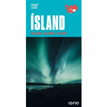
The Hornstrandir map is a popular activity map that has been used for many years by hikers in Hornstrandir, a uniquely interesting region in the West Fjords. This hiking map contains detailed contour information, vegetation information from satellite data and newly revised information about roads, tracks and hiking paths. On the reverse side is a complete list of all names on the map. Scale: 1:100 000. Language: Icelandic, English.
Technical details
| Brand | Idnu |
|---|---|
| Country | Iceland |
| Type | Hiking map |
| Series | Idnu |
| Sheet reference | SÉRKORT 3 HORNSTRANDIR |
| Article number | FE-21007 |
| ISBN | 9789979675143 |
| EAN | 9789979675143 |
| Date of publication | 2021 |
| Scale | 1:100 000 |
| Folded size | 10,50 x 21cm |
| Additional information | Language: Icelandic, English. |
| Warranty | 2 years |
| Country of Manufacture | Iceland |
verified customer reviews 
Only customers who have ordered this product from us can give their opinion on our products, but you can contact us for questions, returns and advice.


