The opinion of Aventure Nordique
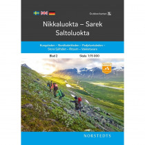
Saltoluokta - Padjelanta - Kvikkjokk: the coverage area is suitable for mountain hiking and outdoor sports: canoeing, skating, backcountry skiing, etc .... Scale 1:75 000. The map shows summer and winter trails routes, and guarded or unguarded shelters.
Points to remember
The map is printed on waterproof paper which comes in handy during wilderness trips. Legend in English. Compatible GPS (TM grid Sweref 99). Covers the following areas: Saltoluokta, Padjelanta, Kvikkjokk, Sarek, Staloluokta, Sulitelma (Kunglseden, Nordkalottleden, Padjelantaleden).
Technical details
| Brand | Norstedts |
|---|---|
| Country | Sweden |
| Type | Hiking map |
| Series | Outdoorkartan |
| Sheet reference | Blad 3 |
| Article number | 9789113105000 |
| EAN | 9789113105000 |
| Date of publication | 2020 |
| Scale | 1:75 000 |
| Folded size | 13 x 21 cm |
| Weight | 81 g |
| Additional information | Two-sided waterproof map |
| Warranty | 2 years |
| Country of Manufacture | Latvia |
verified customer reviews 
Only customers who have ordered this product from us can give their opinion on our products, but you can contact us for questions, returns and advice.


