


The opinion of Aventure Nordique
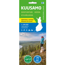
The outdoor map Ruka Oulanka (Bear Trail) covers the most beautiful trekking areas of Kuusamo. Included are the popular Karhunkierros Hiking Trail, Oulanka National Park, the hiking trails and cross-country ski trails in the vicinity of Ruka Resort and the inviting fishing spots of the River Kuusinkijoki. The region is popular among cross-country skiers, hikers, fishers and snowmobilers.
In addition to detailed information on the terrain, the map shows e.g. the wilderness huts, hiking trails, snowmobile routes, eating places, accommodations and sights. Also paddling and white-water routes are shown. The Karhunkierros Trail and the Pieni Karhunkierros Trail are in their own colours to separate them clearly from the other trails. There is a larger version of the Pieni Karhunkierros Trail on the side of the map as well as a map of the Ruka Resort with road names, travelling information and details on services provided in the resort. The map has the WGS 84 coordinates of all the wilderness huts in the area and magnetic declination information.
The map can be used with three coordinate systems (metric ETRS-TM35FIN, geographic grid EUREF-FIN and the metric YKJ Uniform Coordinate System) and with a GPS device. The scale of the map is 1:50,000 (1 cm on the map = 500 m on the ground), and it is double-sided.
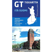
Technical details
| Brand | Karttakeskus |
|---|---|
| Country | Finland |
| Map Type | Hiking maps |
| Article number | 9789522666741 |
| ISBN | 978-952-266-674-1 |
| EAN | 9789522666741 |
| Date of publication | 2020 |
| Scale | 1:50 000 |
| Folded size | 10 x 20 cm |
| Weight | 48 g |
| Warranty | 2 years |
| Country of Manufacture | Latvia |
verified customer reviews 
Only customers who have ordered this product from us can give their opinion on our products, but you can contact us for questions, returns and advice.
Questions & Answers
Be the first to ask a question about this product
Related Products
You may also be interested

Remonter

 Find out more
 Find out more
L'avis de nos aventuriers
Tip-top experience
Very satisified with the whole process, the handling and shipping was ...
Fast shipping
Fast shipping, perfect experience!
I found niche items t...
I found niche items that were hard to get hold of elsewhere and the sh...
Fast delivery
Fast delivery. Great products
One of the best (web)...
Everything was great, website, service, answering questions. Very frie...
Unnecessarily complic...
Unnecessarily complicated retour procedere for defective items.
Checkout experience a...
Checkout experience and international shipping experience are excellen...
Price and quality are...
Price and quality are good. Web site usability is nice. Destination s...
Ici, vous achetez en toute sécurité
Cette boutique répond aux critères de qualité de Trusted Shops
Protection acheteur
Votre achat est assuré jusqu'à 2500€ quel que soit votre mode de paiement
© 2010 - 2026 Aventure Nordique Ltd - Legal - Terms & conditions - Privacy policy - Personal data - Manage your cookies