The opinion of Aventure Nordique
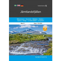
Fulufjället - Trysil - Sälen is part of the Outdoorkartan series of topographic maps from the Swedish publisher Norstedts. The coverage area is suitable for mountain hiking and for outdoor sports and outdoor activities such as canoeing, skating, Nordic cross-country skiing, etc... Map on a scale of 1:75 000. The map shows summer and winter routes, as well as guarded and unguarded huts.
The map is printed on waterproof paper, which is very practical when going out in the wilderness. Legend in English. GPS compatible (Sweref 99 TM grid). Covers the following locations : Fulufjället, Trysol, Sälen, Gördalen, Sörjön, Transtrandsfjällen, Trysil, Rörbäcksnäs.
Technical details
| Brand | Norstedts |
|---|---|
| Country | Sweden |
| Type | Hiking map |
| Series | Outdoorkartan |
| Sheet reference | Blad 14 |
| Article number | 9789113105116 |
| EAN | 9789113105116 |
| Date of publication | 2020 |
| Scale | 1:75 000 |
| Folded size | 13 x 21 cm |
| Weight | 81 g |
| Additional information |
|
| Warranty | 2 years |
| Country of Manufacture | Latvia |


