The opinion of Aventure Nordique
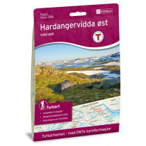
Hiking and outdoor Rauhelleren. The map covers the eastern plateau of Hardangervidda. Covers the area shelters: Mårbu, Solheimstulen, Åan Turisthytte, Mogen, Stordalsbu, Lagaros, Rauhelleren, Stigstuv,Trondsbu. Detailed information on hiking trails and ski slopes. Map Rauhelleren no. 2727 is compatible with GPS (UTM).
Technical details
| Brand | Nordeca |
|---|---|
| Country | Norway |
| Type | Hiking map |
| Series | Turkart |
| Sheet reference | 2727 |
| Article number | 2727 |
| EAN | 7046660027271 |
| Date of publication | 2018 |
| Scale | 1:50 000 |
| Folded size | 14,2 x 20,7 cm |
| Weight | 54 g |
| Warranty | 2 years |
| Country of Manufacture | Norway |
verified customer reviews 
Only customers who have ordered this product from us can give their opinion on our products, but you can contact us for questions, returns and advice.


