The opinion of Aventure Nordique
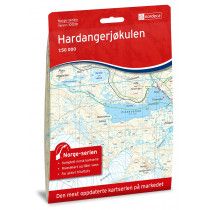
Hiking Finse map at 1: 50 000 covers the area of the Hardangerjøkulen glacier, and a part of the mountains Hallingskarvet. The limits in the North are: Geiterygghytta (DNT Oslo refuge), in the West: Eidfjord, in the South: Dyranut Turisthytta, in the East: Fagerheim Fjellstugu. Finse map is compatible with the GPS (UTM grid).
Technical details
| Brand | Nordeca |
|---|---|
| Country | Norway |
| Type | Hiking map |
| Series | Turkart |
| Sheet reference | 2241 |
| Article number | 2241 |
| ISBN | 7046660022412 |
| EAN | 7046660022412 |
| Date of publication | 2018 |
| Scale | 1:50 000 |
| Folded size | 20,7 x 14,2 cm |
| Weight | 56 g |
| Warranty | 2 years |
| Country of Manufacture | Norway |
verified customer reviews 
Only customers who have ordered this product from us can give their opinion on our products, but you can contact us for questions, returns and advice.


