The opinion of Aventure Nordique
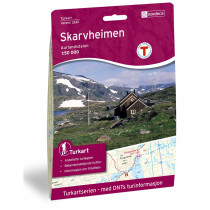
The topographic map Hemsedal North at 1: 50 000 enables to follow the route "north - south" of shelters DNT Sulebu, Breistølen Fjellstue, Bjordalsbu. These place names located within the map: Filefjell, Helin, Hemsedal, Dark Valley, Skogshorn, Vang, Vangsmjøse. This map is compatible with the GPS system. Legend in English.
Points to remember
Technical details
| Brand | Nordeca |
|---|---|
| Country | Norway |
| Type | Hiking map |
| Series | Turkart |
| Sheet reference | 2687 |
| Article number | 2687 |
| EAN | 7046660026878 |
| Date of publication | 2008 |
| Scale | 1:50 000 |
| Folded size | 14,2 x 20,2 cm |
| Weight | 54 g |
| Warranty | 2 years |
| Country of Manufacture | Norway |


