The opinion of Aventure Nordique
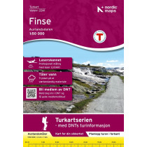
The map of hiking and outdoor Skarvheimen at 1: 50 000 covers the area of Aurlandsdalen , Djupvatnet , Finse , Folarskardnuten , Hallingskarvet , Hallingskarvet National Park. Tour maps with information that ski runs, fotruter, resorts and tourist cabins. The map also has a text page with current information. Legend in English. Skarvheimen map is compatible with the GPS (UTM grid).
Points to remember
Carte en papier résistant contre l'humidité. Idéale pour explorer le parc national de Hallingskarvet et randonner dans la vallée "Aurlandsdalen". Carte permettant de visualiser les secteurs alentours des refuges suivants : Finse, Geiterygghytta, Kongshelleren, Iungsdalshytta, Raggsteindalen, Storestølen, Hallingskeid, Østerbø.
Technical details
| Brand | Nordeca |
|---|---|
| Country | Norway |
| Type | Hiking map |
| Series | Turkart |
| Sheet reference | 2661 |
| Article number | 2661 |
| EAN | 7046660026618 |
| Date of publication | 2018 |
| Scale | 1:50 000 |
| Folded size | 14,2 x 20,2 cm |
| Weight | 54 g |
| Warranty | 2 years |
| Country of Manufacture | Norway |
verified customer reviews 
Only customers who have ordered this product from us can give their opinion on our products, but you can contact us for questions, returns and advice.


