The opinion of Aventure Nordique
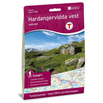
The hiking map covers Glacier and the National Park of Folgefonna and part of the fjord Hardangerfjorden. The map covers the towns of Husnes, Uskedale, Dimmelsvik, Orradalen, Strandemarm, Jondal, Sunndal, Odda and Rosendal. Shelters and hiking trails are marked. Double-sided map at 1: 50 000. Legend in English. The map is compatible GPS (WGS84).
Technical details
| Brand | Nordeca |
|---|---|
| Country | Norway |
| Type | Hiking map |
| Series | Topo 3000 |
| Sheet reference | 3005 |
| Article number | 3005 |
| EAN | 7046660030059 |
| Date of publication | 2016 |
| Scale | 1:50 000 |
| Folded size | 14,2 x 20,7 cm |
| Weight | 55 g |
| Warranty | 2 years |
| Country of Manufacture | Norway |
verified customer reviews 
Only customers who have ordered this product from us can give their opinion on our products, but you can contact us for questions, returns and advice.


