The opinion of Aventure Nordique
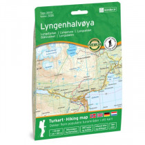
The Lyngen map from Swedish publisher Calazo is a 1:50,000 scale map covering the Lyngen Alps in Norway. This double-sided map covers the Lyngen peninsula and steep mountains.
Produced using the latest airborne laser scanning technology, the map is highly accurate and perfectly reflects the reality of the terrain: streams, rocks, vegetation boundaries, cliffs... This map indicates hiking trails and includes a legend in English.
Made from tyvek, a synthetic fiber, the map is waterproof and highly resistant to tearing. A tyvek map won't tear in the folds or lose its color over time.
Lyngen is one of Norway's most popular regions for ski tours, including the Jiehkkevárri traverse, Storgalten (1,219 m altitude) and Tafeltinden (1,395 m altitude).
Technical details
| Brand | Calazo |
|---|---|
| Country | Norway |
| Type | Hiking map |
| Article number | 9789189371569 |
| EAN | 9789189371569 |
| Date of publication | 2022 |
| Scale | 1:50 000 |
| Folded size | 13 x 21 cm |
| Weight | 55 g |
| Warranty | 2 years |
| Country of Manufacture | Latvia |


