


The opinion of Aventure Nordique
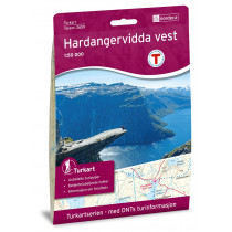
Hardangervidda is a detailed map covering over 3000km2. Here you will find the hiking routes easily and also the lodgings in the area. Covers the following places: Måbødalen - Vøringsfossen - Dyranut - Halne - Mårbu and Hedlo, Hadlaskard, Besso, Sandhaug, Lågaros, Rauhelleren, Trondsbu, Stigstuv, Åan, Tuva, Kjeldebu, Krækkjahytta. Compatible with the EUREF89 GPS system (WGS 84). Waterproof paper.
Technical details
| Brand | Nordeca |
|---|---|
| Country | Norway |
| Map Type | Hiking maps |
| Series | Topo 3000 |
| Sheet reference | 3006 |
| Article number | 3006 |
| EAN | 7046660030066 |
| Date of publication | 2020 |
| Scale | 1:50 000 |
| Folded size | 14,2 x 20,7 cm |
| Weight | 55 g |
| Warranty | 2 years |
| Country of Manufacture | Norway |
verified customer reviews 
Only customers who have ordered this product from us can give their opinion on our products, but you can contact us for questions, returns and advice.
Questions & Answers
Be the first to ask a question about this product
Related Products
You may also be interested
Remonter

 Find out more
 Find out more
L'avis de nos aventuriers
Fast shipping
Fast shipping, perfect experience!
I found niche items t...
I found niche items that were hard to get hold of elsewhere and the sh...
Fast delivery
Fast delivery. Great products
One of the best (web)...
Everything was great, website, service, answering questions. Very frie...
Unnecessarily complic...
Unnecessarily complicated retour procedere for defective items.
Checkout experience a...
Checkout experience and international shipping experience are excellen...
Price and quality are...
Price and quality are good. Web site usability is nice. Destination s...
Excellent shopping ex...
Excellent shopping experience. I purchased an MSR Hubba Hubba HD 3 ten...
Ici, vous achetez en toute sécurité
Cette boutique répond aux critères de qualité de Trusted Shops
Protection acheteur
Votre achat est assuré jusqu'à 2500€ quel que soit votre mode de paiement
© 2010 - 2026 Aventure Nordique Ltd - Legal - Terms & conditions - Privacy policy - Personal data - Manage your cookies