






























The opinion of Aventure Nordique
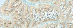
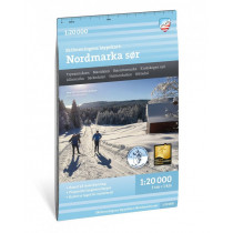
The Løypekart Nordmarka North map is one of four special 1:20,000-scale maps covering the Oslomarka area. It was developed in close collaboration with the Ski Federation. This series of maps is specifically designed for winter use and covers more than 3,000 kilometers of groomed trails.
At a scale of 1:20,000, this map shows groomed cross-country ski trails, distances, and practical amenities such as parking lots, shelters, and places to eat.
The main locations and areas featured on the map include: Grua, Trantjern, Ringkollen, Løvlia, Sinnerdammen, Oppkuven, Katnosdammen, Kikut, and Varingskollen.
Points to remember
Covers the northern part of this vast forested region located north of Oslo, Norway, which is ideal for cross-country skiing. This map will help you find your way around this northern part of Nordmarka.
Technical details
| Brand | Calazo |
|---|---|
| Country | Norway |
| Map Type | Ski trail maps |
| Sheet reference | 9789189880290 |
| Article number | 9789189880313 |
| EAN | 9789189880313 |
| Date of publication | 2024 |
| Scale | 1:20 000 |
| Dimensions | 70 x 100 cm |
| Folded size | 13 x 21 cm |
| Materials | Tyvek |
| Weight | 53 g |
| Additional information | Map legend in English |
| Warranty | 2 years |
| Country of Manufacture | Latvia |
verified customer reviews 
Questions & Answers
Be the first to ask a question about this product
Related Products
You may also be interested

L'avis de nos aventuriers

Ici, vous achetez en toute sécurité
Cette boutique répond aux critères de qualité de Trusted Shops

Protection acheteur
Votre achat est assuré jusqu'à 2500€ quel que soit votre mode de paiement