


The opinion of Aventure Nordique
The Topo 3000 Gaustatoppen map published by Nordic Maps is an accurate and reliable navigation tool for exploring the surroundings and mountains of Gaustatoppen (1883 m), the emblematic peak of southern Norway.
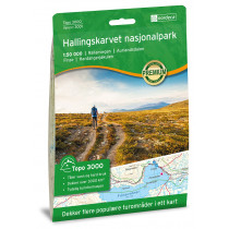
This 1:50,000 map covers the following areas: Rjukan, Tinnsjå, Veggli, Blefjell and the huts: Daggrøhytta, Øvre fjellstul, Eriksbu, Sigridsbu, Selsli, Skinnarbu, Rjukan Mountain Lodge, Gaustatoppen Tourist Lodge, Kalhovd Tourist Lodge, Kvitåvatn Mountain Lodge, Ble Mountain Lodge.
Points to remember
If you want to explore the heights of Gaustatoppen and the surrounding valleys, this is the map for you! It's made from moisture-resistant fibres! Welcome to the highest point in Norway's Telemark county!
Technical details
| Brand | Nordeca |
|---|---|
| Country | Norway |
| Map Type | Hiking maps |
| Series | Topo 3000 |
| Sheet reference | 3018 |
| Article number | 3018 |
| EAN | 7046660030189 |
| Date of publication | 2018 |
| Scale | 1:50 000 |
| Folded size | 14,2 x 20,7 cm |
| Weight | 55 g |
| Warranty | 2 years |
| Country of Manufacture | Norway |
verified customer reviews 
Only customers who have ordered this product from us can give their opinion on our products, but you can contact us for questions, returns and advice.
Questions & Answers
Be the first to ask a question about this product
Related Products

You may also be interested

Remonter

 Find out more
 Find out more
L'avis de nos aventuriers
Happy with the goods ...
Happy with the goods and with delivery. No troubles at all. Thank you ...
Tip-top experience
Very satisified with the whole process, the handling and shipping was ...
Fast shipping
Fast shipping, perfect experience!
I found niche items t...
I found niche items that were hard to get hold of elsewhere and the sh...
Fast delivery
Fast delivery. Great products
One of the best (web)...
Everything was great, website, service, answering questions. Very frie...
Unnecessarily complic...
Unnecessarily complicated retour procedere for defective items.
Checkout experience a...
Checkout experience and international shipping experience are excellen...
Ici, vous achetez en toute sécurité
Cette boutique répond aux critères de qualité de Trusted Shops
Protection acheteur
Votre achat est assuré jusqu'à 2500€ quel que soit votre mode de paiement
© 2010 - 2026 Aventure Nordique Ltd - Legal - Terms & conditions - Privacy policy - Personal data - Manage your cookies