





























The opinion of Aventure Nordique
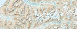
This 1:50,000 map covers the eastern part of Hardangervidda, from Rauhellaren in the west to Rjukan in the south. Classic hiking destinations include Heinseter, Mårbu, Kalhovd, and Gaustatoppen (1,883 m above sea level).
Covers the following locations: Sæterdalen, Rødberg, Uvdal, Tessungdalen, Austbygde, Åtrå, Mælshaugen, Rauhellaren, Heinseter, Mårbu, Kalhovd.
This outdoor map from Calazo shows marked trails, DNT mountain huts, and private cabins. It includes marked cross-country ski trails and groomed trails. Legend in English.
The map is printed on Tyvek, a material made of synthetic fibers that makes it completely waterproof and highly tear-resistant. A Tyvek map does not tear at the folds and does not fade with use.
Points to remember
Technical details
| Brand | Calazo |
|---|---|
| Country | Norway |
| Map Type | Hiking maps |
| Article number | 9789189880276 |
| EAN | 9789189880276 |
| Date of publication | 2026 |
| Scale | 1:50 000 |
| Dimensions | 70 x 100 cm |
| Folded size | 13 x 21 cm |
| Materials | Tyvek |
| Weight | 55 g |
| Additional information | 1:50,000: 2 cm on the map = 1 km on the ground. |
| Warranty | 2 years |
| Country of Manufacture | Latvia |
verified customer reviews 
Questions & Answers
Be the first to ask a question about this product
Related Products
You may also be interested


L'avis de nos aventuriers

Ici, vous achetez en toute sécurité
Cette boutique répond aux critères de qualité de Trusted Shops

Protection acheteur
Votre achat est assuré jusqu'à 2500€ quel que soit votre mode de paiement