


The opinion of Aventure Nordique
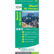
IGN's Top 25 3235 OT is a 1:25,000 hiking map. It covers the northern part of the massif, the 4 montagnes sector, part of the Coulmes and part of the Isère valley between Tullins and Vinay. You'll need this map if you're setting off on the GR9 or GR 91, or if you're doing the GRP Tour des 4 montagnes. It will enable you to discover, among other things: the Moucherotte, the 3 Pucelles, the Pic St Michel, the Molière plateau, the Bec d'Orient, the Cornafion plateau, the Bois Barbu estate, the Ecouges valley and the Coulmes forest. And also the villages of Lans en Vercors, St Nizier du Moucherotte, Rencurel, Villard de Lans and Autrans-Méaudre.
Technical details
| Brand | IGN |
|---|---|
| Country | France |
| Map Type | Hiking maps |
| Series | Top 25 |
| Article number | 46011 |
| EAN | 9782758551942 |
| Scale | 1:25 000 |
| Folded size | 9,6 x 14,3 cm |
| Weight | 100 g |
| Warranty | 2 years |
| Country of Manufacture | France |
verified customer reviews 
Questions & Answers
Be the first to ask a question about this product
Related Products

You may also be interested

L'avis de nos aventuriers

Ici, vous achetez en toute sécurité
Cette boutique répond aux critères de qualité de Trusted Shops

Protection acheteur
Votre achat est assuré jusqu'à 2500€ quel que soit votre mode de paiement