


The opinion of Aventure Nordique
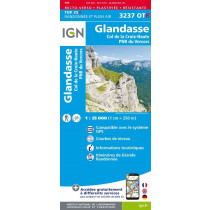
IGN's Top 25 3237 OT is a hiking map with a scale of 1:25,000. It covers the southern part of the Hauts-Plateaux du Vercors Nature Reserve, part of the Diois and part of the Trièves. This is the map to have if you want to discover the Col du Rousset, the Glandasse, the Queyrie plain, the Jocou, the Col de la Croix-Haute and the area around Châtillon en Diois.
Like all maps in the Top 25 series, it features a wealth of precise details: roads, paths, vegetation types, waterways, caves, dwellings, etc. Tourist information is also included: lookouts, refuges, campsites, cross-country ski trails, tourist office, FFRP-marked routes (GR and GRP).
The contour lines have an equidistance of 10 meters, and show the relief through the projected shadow.
The scale is 1:25,000, which means that one centimeter on the map corresponds to 250 meters in the field. The grid is GPS-compatible.
Points to remember
Technical details
| Brand | IGN |
|---|---|
| Country | France |
| Map Type | Hiking maps |
| Series | Top 25 |
| Sheet reference | 3237 OT |
| Article number | 46071 |
| EAN | 9782758552833 |
| Date of publication | 2022 |
| Scale | 1:25 000 |
| Folded size | 9,6 x 14,3 cm |
| Weight | 100 g |
| Warranty | 2 years |
| Country of Manufacture | France |
verified customer reviews 
Questions & Answers
Be the first to ask a question about this product
Related Products
You may also be interested

L'avis de nos aventuriers

Ici, vous achetez en toute sécurité
Cette boutique répond aux critères de qualité de Trusted Shops

Protection acheteur
Votre achat est assuré jusqu'à 2500€ quel que soit votre mode de paiement