


The opinion of Aventure Nordique
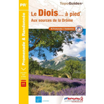
This map-guide offers 936 km of waymarked and signposted itineraries for exploring the Diois, an area south of the Vercors massif.
The Diois is a land of generous nature, rich in colour and fragrance. Along the way, discover spectacular landscapes, remarkable biodiversity and a rich cultural heritage that bear authentic witness to the history and identity of the Vercors.
Points to remember
Both a map and a guidebook offering 35 (35 in French and 13 in English) walking itineraries across the Diois. Each route includes a description, duration, distance, altitude difference, level and accessibility. IGN map base with a scale of 1.5 cm corresponding to 500 metres. An ideal paper guide to help you understand and explore the area.
Technical details
| Brand | Parc Naturel Régional du Vercors |
|---|---|
| Country | France |
| Map Type | Hiking maps |
| Sheet reference | 41269 |
| Article number | RVDIOIS24 |
| EAN | 9782909964256 |
| Date of publication | 2016 |
| Scale | 1:33 333 |
| Folded size | 11,5 x 20,5 cm |
| Weight | 90 g |
| Additional information | Suggested walks from the villages:
|
| Warranty | 2 years |
| Country of Manufacture | France |
verified customer reviews 
Questions & Answers
Be the first to ask a question about this product
Related Products
You may also be interested

L'avis de nos aventuriers

Ici, vous achetez en toute sécurité
Cette boutique répond aux critères de qualité de Trusted Shops

Protection acheteur
Votre achat est assuré jusqu'à 2500€ quel que soit votre mode de paiement