The opinion of Aventure Nordique
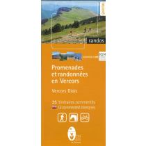
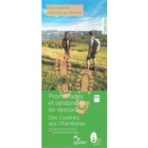
This map-guide offers 437km of waymarked and signposted routes to discover the Vercors Drômois, located in the centre of the massif.
The trails take you through the villages of Vassieux-en-Vercors, Saint-Agnan-en-Vercors, Rousset-en-Vercors, la Chapelle-en-Vercors, Saint-Julien-en-Vercors and Saint-Martin-en-Vercors.
Points to remember
Both a map and a guidebook offering 22 (22 in French and 5 in English) walking itineraries across the Vercors Drôme. Each route includes a description, duration, distance, altitude difference, level and accessibility. IGN map base with a scale of 1.5 cm corresponding to 500 metres. An ideal paper guide to help you understand and explore the area.
Technical details
| Brand | Parc Naturel Régional du Vercors |
|---|---|
| Country | France |
| Type | Hiking map |
| Sheet reference | 28659 |
| Article number | 28659 |
| EAN | 9782909964195 |
| Date of publication | 2018 |
| Scale | 1:33 333 |
| Folded size | 11,5 x 20,5 cm |
| Weight | 90 g |
| Additional information | Suggested walks from the villages:
|
| Warranty | 2 years |
| Country of Manufacture | France |


